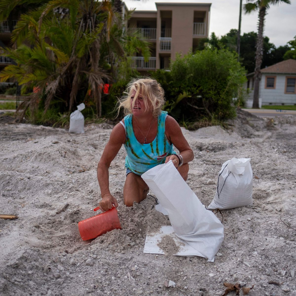
Millions of Floridians are preparing for life-threatening storm surges, devastating winds, and flooding as a category four hurricane approaches their coastline.
Later on Wednesday, Hurricane Ian, which has already devastated western Cuba, will make landfall in Florida.
The storm is “rapidly increasing” as its maximum sustained winds approach 250 km/h (155 mph), according to the National Hurricane Center (NHC).
It is expected to strike the Tampa Bay area.
The region is among the most susceptible to severe flooding in the United States, and if Ian follows its predicted path, this will be the first direct impact by a major hurricane since 1921.
“It has been around a century since Tampa was struck by a direct blow. They have been fortunate for a very long time “Associate director of the International Hurricane Research Center Erik Salna stated.
The probability of a catastrophic tidal surge is increased by low altitude, rising sea levels, and a huge population. Mr. Salna claims that all three are present in the Tampa area.
If struck directly, he predicted, the region may become “unrecognizable” within the next several days. “The possibility exists.”
As reported by air force hurricane hunters, Hurricane Ian was approximately 75 miles (125km) off the coast at 05:00 local time (09:00 GMT) when the NHC stated it had become a category four storm.
There are five categories, and Ian currently holds the second-highest level. Category four hurricanes have winds of 209 to 156 miles per hour (130 to 156 mph). The fifth storm level corresponds to winds of at least 252 km/h (157 mph).
The zone at greatest risk extended from Naples to Sarasota, according to the NHC, which advised locals to listen to authorities and comply with evacuation instructions.
As Ian neared the coast, the National Weather Service reported that tornadoes had already been spotted in southern Florida. The NHC warned that conditions were “rapidly deteriorating” over the southwest coast of Florida at 06:00 local time (11:00 GMT).
A buoy stationed north-northwest of the storm’s eye recently detected sustained winds of 106 kilometers per hour (66 miles per hour), and a weather flow station near Sanibel Island recorded sustained winds of 63 kilometers per hour (39 mph).
As Ian approaches Florida, it will likely lose speed, effectively prolonging the storm’s effects and threatening up to 20 inches (1.6 feet) of rain in certain regions.
And if it does impact Tampa, it will strike one of the most populous areas in the state.
Over the past half-century, development along the Tampa region’s almost 700 miles (1,1200km) of coastline has exploded, with people and houses strewn over the generally low-lying beach.
“We have proceeded towards the coast, towards the water. This is, in its way, a train wreck of human nature “According to Richard Olson, director of the institute for extreme events at Florida International University (FIU).
Mr. Olson stated that “under evacuation” was his “continuous fear” as Hurricane Ian approached the coast. More than 2.5 million Floridians in a variety of coastal towns and cities have begun evacuating, with police in some locations going door-to-door and pleading with citizens to flee. The mayor of Tampa Bay, Jane Castor, announced on Tuesday that the city would establish a curfew for surviving inhabitants.
“This is not a drill,” Mayor Castor informed the community. “I don’t believe it can get any worse, but I’m certain there is a scenario in which it may.”
Tuesday, Florida Governor Ron DeSantis issued his warning, advising citizens in an evacuation zone that “your time is coming to an end” and urging those who had not yet decided to “act immediately.”
From Bonita Beach in the south to Anclote River north of Tampa, the National Hurricane Center issued a 175-mile-wide hurricane warning, citing a 100 percent possibility of destructive winds and water along Florida’s west coast.
Residents have purchased large quantities of water bottles, boarded up windows, and moved garden equipment indoors. Universities and schools have also canceled classes for the week.
As the hurricane approaches, Disney World, Sea World, and Busch Gardens in Tampa are closing, and NASA has postponed the launch of a moon rocket from Kennedy Space Center.
The Artemis I Moon rocket, whose launch has already been delayed twice, has been transferred from the launchpad to the vehicle assembly facility in preparation for the approaching storm.
As Tuesday’s aircraft landed in Tampa, citizens were notified via mobile phone notifications of mandatory evacuation orders throughout the region.
A man at the airport stated that he had never faced the possibility of a hurricane of this magnitude in his 43 years of living in the area. He stated, “This is the quiet before the storm.”
Residents in Tampa are hopeful that the hurricane will drift slightly south and make landfall in the less crowded region of Fort Myers.
Hugh Willoughby, a professor of meteorology at Florida International University, said, “I played with the notion of creating a disaster film – a storm crosses Cuba, intensifies, and moves up the west coast of Florida – you know how these films go.”
